Explanatory Notes on Main Statistical Indicators
Cultivated Land refers to land mainly for the regular cultivation of farm crops (including vegetables), with some fruit trees, mulberry trees and others, covers cultivated land, newly-developed land, reclaimed land, consolidated land, fallow, beach land that can guarantee one harvest per year on average. It also covers fixed ditch, canal, road and sill (ridge) with width less than 1 meter in the South and 2 meters in the North, lands planted temporarily with herbs, grass, flowers and nursery stocks, and other cultivated land with temporary change of use.
Garden Land refers to land for intensive cultivation of perennial woody plants and herbs to collect fruits, leaves, roots, stems and juice, with a coverage rate over 50% and plant number over 70% of rational plant number per mu. Land for nursery is included.
Forest and refers to land for planting arbor, bamboo, bush shrub and land in coastal zones for planting mangrove. It includes slash, but not covers the green belts in residential area, forests requested for railway and highway, and the dike protection forest around rivers and ditches.
Land under Meadows and Pastures refers to land mainly for the growth of herbaceous forage cropss
Volume of Runoff refers to the total volume of water running through a certain cross section of a river during a certain period of time, reflecting the water resources condition in a country or a region. The formula for calculating volume of runoff is as follows:
River Runoff =Precipitation- Evapotranspiration
Drainage Area Each river has its own main stream and branches to form the water system of the river. Each river has its own catchment’s area, which is also called as the drainage area of the river.
Out-flowing Rivers refer to rivers directly or indirectly flowing into the sea. The area providing water to the out-flowing rivers is called as out-flowing area.
Inland Rivers refer to rivers in inland dry areas that die away in desert on the way or infuse into inland lakes. The area providing water to the inland rivers is called as inland area.
Mineral Resources refer to useful minerals, with solid state, liquid state, gaseity, due to the geological process. Minerals are important natural resources, and important material base for economic and social development. At present, there are more than 170 types of minerals discovered in China. They can be categorized into four groups: energy minerals (including coal, petroleum, natural gas and terrestrial heat), metallic minerals (including iron, manganese, copper, lead and bauxite), nonmetallic minerals (including diamond, limestone and clay), and water/gas related minerals (including ground water, mineral water and carbon dioxide). Metallic minerals can be further classified as ferrous, non-ferrous, noble metal, rare metal, rare earth and dispersed metals.
The Remaining Reserves of Non-oil and Gas Resources refer to the sum of contingent resources and discovered reserves of non-oil in according to the Classification of Solid Mineral Resources/Reserves (GB/T17766-1999).
Average Temperature It refers to the average air temperature on a regular basis. China uses centigrade as the unit. The thermometry used for weather observation is put in a breezy shutter, which is 1.5 meters high from the ground. Therefore, the commonly used temperature refers to the temperature in the breezy shutter 1.5 meters away from the ground. The calculation method is as follows:
Monthly average temperature is the summation of average daily temperature of one month divided by the actual days of that particular month.
Annual average temperature is the summation of monthly average of a year divided by 12 months.
Average Relative Humidity refers to the ratio of actual water vapour pressure to the saturation water vapour pressure under the current temperature. The calculation method is the same as that of temperature.
Volume of Precipitation refers to the deepness of liquid state or solid state (thawed) water falling from atmosphere reaching to the Earth’s surface that has not been evaporated, percolate or run off. The calculation method is as follows:
Monthly precipitation is the summation of daily precipitation of a month.
Annual precipitation is the summation of 12 months precipitation of a year.
Sunshine Hours refer to the actual hours of sun irradiating the earth, usually expressed in hours. The calculation method is the same as that of the precipitation.
Total Water Resources refers to total volume of surface water and groundwater which is from the local precipitation and is measured as the summation of run-off for surface water and recharge of groundwater from local precipitation.
Surface Water Resources refers to total volume of year renewable water flow which exist in rivers, lakes, glaciers and other surface water, and that measured as the natural run-off of rivers.
Groundwater Resources refers to total volume of yearly renewable water flow which exist in saturation acquifers of groundwater, and are measured as recharge of groundwater from local precipitation and surface water.
Overlapped Measurement between Surface Water and Groundwater refers to the part of mutual transfer between surface water and groundwater, i.e. which is the run-off of rivers includes some depletion into groundwater while groundwater includes recharge from surface water.
Water Supply refers to gross water of various sources supplied to consumers, including losses during distribution.
Surface Water Supply refers to withdrawals through the surface water supply system, broken down with storage, flow, pumping and transfer project. Supply from storage projects includes withdrawals from reservoirs; supply from flow includes withdrawals from rivers and lakes with natural flows regardless of locks or no lockt; supply from pumping projects includes withdrawals from rivers or lakes with pumping stations; and supply from transfer project refers to water supplies transferred from first-level regions of water resources or independent river drainage areas to others, and exclude from the supplies of storage, flow and pumping.
Groundwater Supply refers to withdrawals from supplying wells, broken down with shallow layer freshwater, deep confided freshwater and slightly brackish water. Groundwater supply for urban areas includes water abstraction is the summation of both waterworks and own-use wells enterprises.
Other Water Supply Sources include supplies through wastewater treatment, rain collection, seawater desalinization and other water projects.
Water Use refers to gross water used by various water users, including losses during distribution.
Water Use for Agriculture includes uses of water for irrigation of farming fields, forestry and orchards, irrigation of grassland, replenishment of fishing farms and water used for animal husbandry.
Water Use for Industry refers to new withdrawals of water, excluding reuse of water within enterprises.
Water Use for Residential includes use of water for residential in both urban and rural areas. Urban water useof residential is composed of household use and public use (including tertiary industry and construction). Rural water use for residential includes water used by households.
Water Use for Ecological purposes includes recharge of rivers , lakes and wetlands, and use for urban environment protection.
Common Industrial Solid Wastes Generated refers to the amount of common industrail solid wastes the surveyed units actual generated over the year. The common industrial solid wastes refers to the industrial solid wastes that are not listed in the 《National Catalogue of Hazardous Wastes》(2016 Version), or not regarded as hazardous according to the National Hazardous Waste Identification Standards (GB5085), the Solid Waste-Extraction Procedure for Lleaching Toxicity (GB5086) and the Assay Method of Solid Waste-Extraction Procedure for Leaching Toxicity (GB/T 15555).
Common Industrial Solid Wastes Integrated Use refers to amount of solid wastes from which useable materials can be extracted or converted into usable resources, energy or other materials through reclamation, processing, recycling and exchange (including utilizing in the year the stocks of industrial solid wastes of the previous year) generated by surveyed units over the year of the survey, e.g. being used as agricultural fertilizers, building materials or as material for paving road. The information should be measured as the unit of generating wastes.
Common Industrial Solid Wastes Disposed refers to the amount of industrial solid wastes disposed, which covers the amount of previous years, through incineration or other methods to change its physical, chemical and biological propertiesto reduce or eliminate the hazardsor landfilled in the sites following the requirements for environmental protection by surveyed units over the year of the survey.
Stock of Common Industrial Solid Wastes refers to the amount of solid wastes placed in special facilities or special sites by enterprises for the purposes of integrated use or disposal over the year of the survey. The sites or facilities should take measures against dispersion, loss, seepage, and air and water contamination.
Common Industrial Solid Wastes Discharged refers to the amount of industrial solid wastes dumped or discharged by producing enterprises to disposal facilities or to other sites over the year of the survey.
Hazardous Wastes Generated refers to the amount of actual hazardous wastes generated by surveyed units over the year of the survey, which is covered secondary generation during the process of disposal and reuse of hazardous wastes. Hazardous waste refers to those listed in the National Hazardous Wastes catalogue or identified as any one of the following properties in light of the national hazardous wastes identification standards and methods: explosive, ignitable, oxidizable, toxic, corrosive or liable to cause infectious diseases or lead to other dangers. It should be reported following the National Catalogue of Hazardous Wastes (2016 Version).
Hazardous Wastes Integrated Reused and Disposed Hazardous Wastes Integrated Reused refers to the amount of hazardous wastes that are used to extract materials for raw materials or fuel over the year of the survey, including own-use by the producing enterprise and other use of enterprises. Hazardous Wastes Disposed refers to the amount of hazardous wastes which are incineration or specially disposed using other methods to change itsits physical, chemical and biological properties and thus to reduce or eliminate the hazards, or placed ultimately in the sitesfollwoing the requirements for environmental protection over the year of the survey.
Year-end Stock of Hazardous Wastes refers to the amount of hazardous wastes specially packaged and placed in special facilities or special sites by enterprises, which covered stock of surveyed units generated and received from other units. The special stock facilities should meet the requirements set in relevant environment protection laws and regulations such as “Pollution Control Standards for Hazardous Waste Stock” (GB18597-2001) in regard to package of hazardous waste, location, design, safety, monitoring and shutdown, and take measures against dispersion, loss, seepage, and air and water contamination.
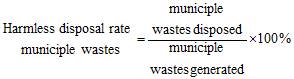
Municiple Wastes Transported refers to amount of municiple wastes collected and transported to disposal factories or sites during the reference period. Municiple wastes are solid wastes generated from urban households or from service activities for urban households, and solid wastes regarded by laws and regulations as municiple wastes, including those from households, commercial activities, markets, cleaning of streets, public sites, offices, schools, factories, mining units and other sources.
Treated Ratio of municiple Wastes refers to the amount ofmunicple wastes treated over the generation amount. Accutually it is difficult to get the amount of generation of municiple wastes, so in practise it is substituted by that the amount of municiple wastes transported. It is calculated as:
Forest Area refers to the area of trees and bamboo grow with a canopy density above 0.2 degree, the area of shrubby tree according to regulations of the government, area of land under agroforestry and the area of trees planted by the side of villages, farm houses and along roads and rivers.
Area of Planted Forests refer to the area of stable growing forests, planted manually or by airplanes, with a survival rate of 80% or higher of the designed number of trees per hectare, or with a canopy density of 0.20 degree or above (after 3-5 years of manual planting or 5-7 years of airplane planting).
Forest Coverage Rate refers to the percentage of afforested land area to the total land area.within the administrative region, The formula is as follows:
![]()
Total Living Forest Stock Volume refers to the total stock volume of timber of living treeswithin the given region, including forest,trees sparse trees, scattered trees and trees planted by the side of villages, farm houses and along roads and rivers.
Stock Volume of Forest refers to total stock volume of timber of tree trunk in a given forest area, which shows the total size and level of forest resources of a country or a region.
Area of Afforestation refers to the total area of land suitable for afforestation, including barren hills, idle land, sand dunes, non-timber forest land, woodland and “grain for green” land, on which acres of forests, trees and shrubs are planted through manual planting.
Manual Planting refers to technical measures of sowing, planting seedlings and divided transplanting on land suitable for afforestation, including barren hills, idle land, sand dunes, non-timber forest land, woodland and “grain for green” land to increase vegetation coverage rate of forests.
Airplane Planting refers to technical measures of airplane planting with of appropriate artificial help taken under the influence of natural power to restore certain amount of seedlings on land suitable for afforestation, , with an aim of increasing vegetation coverage rate of forests or improving forest quality. It includes barren afforestation and aerial seeding forest afforestation.
New Closing Hillsides to Facilitate Afforestation is a technical measure by islation with aritificial means to form forest or shrub and grass or improve forest qualityland, to the suitable area for forest, forest land without stumpage, sparse forest land, or low quality forest, shrub forest.
Restoration of Degraded Forest In order to improve the vitality and structure of forest, effectively control forest degradation, improve forest quality and restore forest function, management measures are taken to the forest of structural imbalance and stability reduction, function reduction or even loss and natural regeneration ability is weak, which include structural adjustment, species replacement, replanting sowing, grafting rejuvenation, etc.
Artificial Regeneration refers to forest reforming process in logging slash, Slash Burning, the glade through afforestation. Including artificially promoting natural regeneration of promoting the growth and development of target tree species seedlings by weeding, root pruning or stubble rejuvenation, sowing and replanting, removing tillering and thinning, etc.
Wetlands refer to marshland and peat bog, whether natural or man-made, permanent or temporary; water covered areas, whether stagnant or flowing, with fresh or semi-fresh or salty water that is less than 6 meters deep at low tide; as well as coral beach, weed beach, mud beach, mangrove, river outlet, rivers, fresh-water marshland, marshland forests, lakes, salty bog and salt lakes along the coastal areas.
Natural Reserves refer to number of certain areas of land, or waters that have been set aside and put under special protection and management in order to protect natural environment and natural resources, and promote the sustainable development of national economy. They are subject to formal approval from governments of various levels. According to the protected targets, natural reserves can be divided into three categories: reserves of natural ecological system, natural reserves of wildlife species, and natural heritage of historical significance. Scenic spots and cultural preservation zones are excluded.
Landslides refer to the geological phenomenon of unstable rocks or soil on slopes sliding down along certain soft surface as a result of gravity.
Collapse refers to the geological phenomenon of large mass of rocks or soil suddenly collapsing from the mountain or cliff as a result of gravitaty.
Mudslide refers to the sudden rush of flood torrents containing large amount of mud and rocks in mountainous areas.
Sinkhole refers to the geological phenomenon of surface rocks or soil subsiding into holes or pits as a result of natural or human factors.
Number of Forest Fires refers to the number of wild fires in forests, woods and woodland outside of cities. In light of the area plagued by fires and the number of casualties, forest fires can be categorized into general forest fires, relatively larger fires, serious forest fires and extraordinary serous forest fires: 1). General forest fires: the destructed forest area is less than 1 hectare, or the fire erupts in other woodland, or the number of deaths is no less than 1 but less than 3, or the number of seriously injured persons is no less than 1 but less than 10 persons. 2). Relatively larger forest fires: the destructed forest area is no less than 1 hectare but less than 100 hectares, or the number of deaths is no less than 3 but less than 10, or the number of seriously injured persons is no less than 10 but less than 50 persons. 3). Serious forest fires: the destructed forest area is no less than 100 hectares but less than 1000 hectares, or the number of deaths is no less than 10 but less than 30, or the number of seriously injured persons is no less than 50 but u less than 100 persons. 4). Extraordinary serious forest fires: the destructed forest area is no less than 1000 hectares, or the number of deaths is no less than 30, or the number of seriously injured persons is no less than 100 persons.
Forest Harmful Organisms refer to the diseases, pests,rats and harmful plants that plague forests, wood, desert and wetland vegetation.
Environmental Emergenciy Events refer to environmental emergency events that caused or likely to cause significant causalities, serious property damages and pose a major threat and damage to the economic, social or political stability of the country or a region, or have significant social impact that related to the public safety.
Number of Earthquakes refers to the number of earthquakes of all magnitude that cause damages (including casualties or economic losses).